Showing 293 results

Archival description
Only top-level descriptions
Print preview View:

25 results with digital objects Show results with digital objects

North Shore and Skokie Valley Electric Stations

  • US IlHpHS R2012-19
  • Item
  • n.d.

This is a map of the North Shore and Skokie Valley Electric Stations. The map was drawn and printed by A.I. Silander and Company Land Surveyors and Landscape Engineers. The electric stations listed on the map are: Ridge Ave., Asbury Ave., Dodge Ave., Crawford-Prairie Ave., Kostner Ave., Oakton St., Main St., Dempster St., Harmswoods, Glenayre, Wau-Bun, Northbrook, Woodridge, Briargate, Highmoor, Sheridan Elms, and Skokie Manor. This map is undated.

A.I. Silander and Company Land Surveyors

Baird and Warner Inc. Addition to Deere Park Sub. being a subdivision...

  • US IlHpHS R2012-22
  • Item
  • 1/29/1926

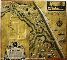
Baird and Warner Inc. Addition to Deere Park Sub. being a subdivision of the Southeast 1/4 of the Southwest 1/4 and the Southwest Fraction 1/4 of Section 31 Township 43 North Range 13 East of the 3rd P.M. Also Lots 13 and 14 in Hill and Stones ravine View Subdivision in the said Southwest 1/4 of Section 31 T.43N. R.13E of 3rd P.M. in the city of Highland Park, Lake County, Illinois. The map shows the area from west to east, Ravinia Court to Lake Michigan and north to south Deere Park Sub. to Sheridan Rd. Approved and accepted by the council of the city of Highland Park, this 29th day of January, A.D. 1926 signed by Samuel M. Hastings, Mayor.

Baird and Warner.

Map of Highland Park and Vicinity Lake County, Illinois

  • US IlHpHS R2012-23
  • Item
  • 1955-1965

The map shows Highland Park and its vicinity. This map has been revised three times: June 3, 1955 by NJP, April 6, 1962 by PEC, and March 2, 1965 by CAM and JLH. The map includes dis-annexed and annexed ordinances and the dates they were passed. The map is presented on vinyl-like material that is translucent.

s.n.

Highland Park School Districts, records

  • US IlHpHS R2012-30
  • Collection
  • 1857-1954

This collection contains materials relating to School Districts 108 and 109 in Highland Park, Illinois. The materials cover the following school properties: Braeside, Lincoln and Ravinia Schools. The files contains blueprints for various parts of the properties, deeds, titles, correspondence, and other research about the properties and locations. The dates of the materials span from the mid 1920s until the mid 1940s.

Highland Park School Districts

Photographs

  • US IlHpHS R2012-34
  • Collection
  • ca. 1956-2002

Collection contains photographs of places and special events around Highland park. Collection includes nine files of photographs organized by subject. There are five files of photo negatives, also organized by subject.

s.n.

Lake County Planning Deptartment : Aerial photographs of Township 43

  • US IlHpHS R2012.30
  • Collection
  • 1986

These black and white aerial photographs of Township 43 (Deerfield, later renamed Moraine) were taken in Spring, 1986. Each photograph shows a different part of Township 43. There is an official seal of Lake County on the bottom right of each page. The photographs were taken by the Sidwell Company, copyright, 1984. Copies on plain paper (not photo paper).

Lake County Planning Department.

Map of Lake County, Illinois from actual surveys and other authentic sources

  • US IlHpHS R2012.31
  • Item
  • 1861-1948

This is a map of Lake County, Illinois by George Hale, county surveyor and J.N.Truesdell, clerk of the circuit court, published by L. Gast Bros. and Co., St. Louis. The map is from actual surveys and other authentic sources. The map shows Lake County in 1861. The map includes historical statistics of Lake County dating back to 1834. It also includes an illustration of the Public Square in Waukegan, a Table of Distances and a table of Statistics. There are also several insets: Waukegan, Antioch, Half Day, Millburn, Wauconda Central Part of Lake Forest, Hainesville, Long Grove, Lake Zurich, Libertyville, Deerfield Village, Forksville, Diamond Lake, O'Plain Bridge, and Barrington. There is a note at the bottom of the page: "Copied to preserve historical record in the office of R.M. Lobdell, County Superintendent of Highways, March 1948, by order of the Board of Supervisors of Lake Co., Guy L. Grinnell, Chairman, from old map furnished by the Lake County Historical Society, Bess Dunn, Secretary by R.M.Brown."

Hale, George

Results 171 to 180 of 293