- US IlHpHS Hous.Fil-112-114
- File
- n.d.
Part of House file
2449 results with digital objects Show results with digital objects
Part of House file
Map showing Lincoln's early homes, etc. (Hay - Nicolas Life)
Map of the City of Highland Park and Vicinity
Part of Culver family papers
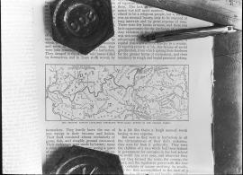
Map of the charge on the 3rd day
Map of the charge on the 3rd day
Map of Lake County, Illinois from actual surveys and other authentic sources
This is a map of Lake County, Illinois by George Hale, county surveyor and J.N.Truesdell, clerk of the circuit court, published by L. Gast Bros. and Co., St. Louis. The map is from actual surveys and other authentic sources. The map shows Lake County in 1861. The map includes historical statistics of Lake County dating back to 1834. It also includes an illustration of the Public Square in Waukegan, a Table of Distances and a table of Statistics. There are also several insets: Waukegan, Antioch, Half Day, Millburn, Wauconda Central Part of Lake Forest, Hainesville, Long Grove, Lake Zurich, Libertyville, Deerfield Village, Forksville, Diamond Lake, O'Plain Bridge, and Barrington. There is a note at the bottom of the page: "Copied to preserve historical record in the office of R.M. Lobdell, County Superintendent of Highways, March 1948, by order of the Board of Supervisors of Lake Co., Guy L. Grinnell, Chairman, from old map furnished by the Lake County Historical Society, Bess Dunn, Secretary by R.M.Brown."
Hale, George
Part of Maps
This is a map of Lake County Illinois by George Hale (County Surveyor) and J.N. Truesdell (Clerk of the Circuit Court). The map includes all the townships in Lake County as well as Historical Statistics of Lake County, an image of the Public Square, Waukegan, Table of Distances, and Statistics.
Hale, George

Map of Highland Park Woodlands
Map shows the Highland park Woodlands: the area between Western and Priscilla (east-west) and Euclid and Burchell (north-south). There are drawings of proposed houses in the area as well as restrictions on the lots. The map was drawn by M.B. Schaeffer, June 20, 1936.
Schaeffer, M. B.
Map of Highland Park and Vicinity, Lake County, IL/ Compiled by Windes and Marsh
Windes & Marsh (Firm).
The map of Highland Park and vicinity was compiled by Windes and Marsh, civil engineers and surveyors. The map is color coded. The date on the map is 1934. However, there is a note: P.E. Cole, city engineer, January 1938. The atlas of the city of Highland Park, Lake County Index sheet shows a street index of Highland Park that is color coded. The index sheet was drawn in 1932 by D.D. Corrough and P.E. Cole and revised 26 Feb 1939 by Corrough and 18 July 1939 by P.E. Cole.
Cole, P.E.