- US IlHpHS scra.sme
- Item
- 1919-1919
High school scrapbook with images, captions, descriptions and clippings. Subjects and people documented include classes, school activities, dances (including partners), friends and teachers.
Smeedon, Mary
11 results with digital objects Show results with digital objects
High school scrapbook with images, captions, descriptions and clippings. Subjects and people documented include classes, school activities, dances (including partners), friends and teachers.
Smeedon, Mary
Map of Lake County, Illinois from actual surveys and other authentic sources
This is a map of Lake County, Illinois by George Hale, county surveyor and J.N.Truesdell, clerk of the circuit court, published by L. Gast Bros. and Co., St. Louis. The map is from actual surveys and other authentic sources. The map shows Lake County in 1861. The map includes historical statistics of Lake County dating back to 1834. It also includes an illustration of the Public Square in Waukegan, a Table of Distances and a table of Statistics. There are also several insets: Waukegan, Antioch, Half Day, Millburn, Wauconda Central Part of Lake Forest, Hainesville, Long Grove, Lake Zurich, Libertyville, Deerfield Village, Forksville, Diamond Lake, O'Plain Bridge, and Barrington. There is a note at the bottom of the page: "Copied to preserve historical record in the office of R.M. Lobdell, County Superintendent of Highways, March 1948, by order of the Board of Supervisors of Lake Co., Guy L. Grinnell, Chairman, from old map furnished by the Lake County Historical Society, Bess Dunn, Secretary by R.M.Brown."
Hale, George

Map of Highland Park Woodlands
Map shows the Highland park Woodlands: the area between Western and Priscilla (east-west) and Euclid and Burchell (north-south). There are drawings of proposed houses in the area as well as restrictions on the lots. The map was drawn by M.B. Schaeffer, June 20, 1936.
Schaeffer, M. B.
Map of Highland Park and Vicinity, Lake County, IL/ Compiled by Windes and Marsh
Windes & Marsh (Firm).
Map of Highland Park and Vicinity Lake County, Illinois
The map shows Highland Park and its vicinity. This map has been revised three times: June 3, 1955 by NJP, April 6, 1962 by PEC, and March 2, 1965 by CAM and JLH. The map includes dis-annexed and annexed ordinances and the dates they were passed. The map is presented on vinyl-like material that is translucent.
s.n.
Log Cabin for Sylvester Millard, Esq.
Drawings for log house.
Boyington, William W.
Ladies Auxiliary to the Veterans of Foreign Wars of the United States
Ledger with membership lists.
Veterans of Foreign Wars of the United States. Ladies Auxiliary.
Ladies Aid Society : Trinity Parish Highland Park
Minutes book.
Trinity Episcopal Church. Ladies Aid Society (Highland Park, Ill.)
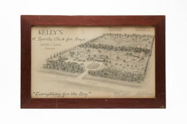
Kelly's : A Sports club for boys
Framed drawing charcoal on paper Kelly's on Hintz Road, Wheeling, Illinois with caption "Everything for the Boy." (Offices in Highland Park, Illinois.)
Kennedy, Tom, Delineator
Highland Park family scrapbooks 1 Turn-of-the-Century family, vacation, pet, university, Lake Michigan Beach and other photos of Highland Park family and friends. 2 World War I images (Hicks Field, Texas), vacation (Niagara Falls), play, pets, and school created by Katherine Block
Block, Katherine