- US IlHpHS 091
- Item
- n.d.
Part of 35mm slides of Highland Park
2477 results with digital objects Show results with digital objects
Part of 35mm slides of Highland Park

Part of Loesch family collection
Part of Loesch family collection
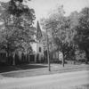
1.4 Highland Park Historical Society
Part of Photographs
Scope and Contents note File contains various pghotographs related to the Highland Park Historical Society and its events. Photos include: a tent promoting house tours, girl scout troop, tea party, and Ravinia School third grade class outside the museum.
Part of Photographs
Scope and Contents note File contains photographs of 3461 Krenn, Highland Park.
Part of Photographs
Scope and Contents note File contains photographs of landmark places around Highland Park. Images include the library, Stupey Log Cabin, Bandstand, a barn, Highland Park First National Bank, City Hall, Water Towerand the Yerkes Horse Trough.
1.13 Moraine Hotel (negatives)
Part of Photographs
Scope and Contents note File contains photo nevatives of different parts or views of the Moraine Hotel, including: wedding tables, buffet tables, a snow scene, and the hotel exterior.
North Shore and Skokie Valley Electric Stations
This is a map of the North Shore and Skokie Valley Electric Stations. The map was drawn and printed by A.I. Silander and Company Land Surveyors and Landscape Engineers. The electric stations listed on the map are: Ridge Ave., Asbury Ave., Dodge Ave., Crawford-Prairie Ave., Kostner Ave., Oakton St., Main St., Dempster St., Harmswoods, Glenayre, Wau-Bun, Northbrook, Woodridge, Briargate, Highmoor, Sheridan Elms, and Skokie Manor. This map is undated.
A.I. Silander and Company Land Surveyors
Highland Park General Development Plan
Part of Maps
This colored map shows the general development plan of Highland Park, Illinois in July, 1924. The map includes a legend: proposed streets and street corrections, proposed street widenings, proposed parkways, existing parks and beaches, proposed parks and beaches, existing school properties, suggested school and playground sites, business districts, and general commericial districts. The plan was developed by the Highland Park Planning Commission and Jacob L. Crane, Jr. was the consultant.
Crane, Jacob L., Jr.
Part of Maps
This is a map of Lake County Illinois by George Hale (County Surveyor) and J.N. Truesdell (Clerk of the Circuit Court). The map includes all the townships in Lake County as well as Historical Statistics of Lake County, an image of the Public Square, Waukegan, Table of Distances, and Statistics.
Hale, George